
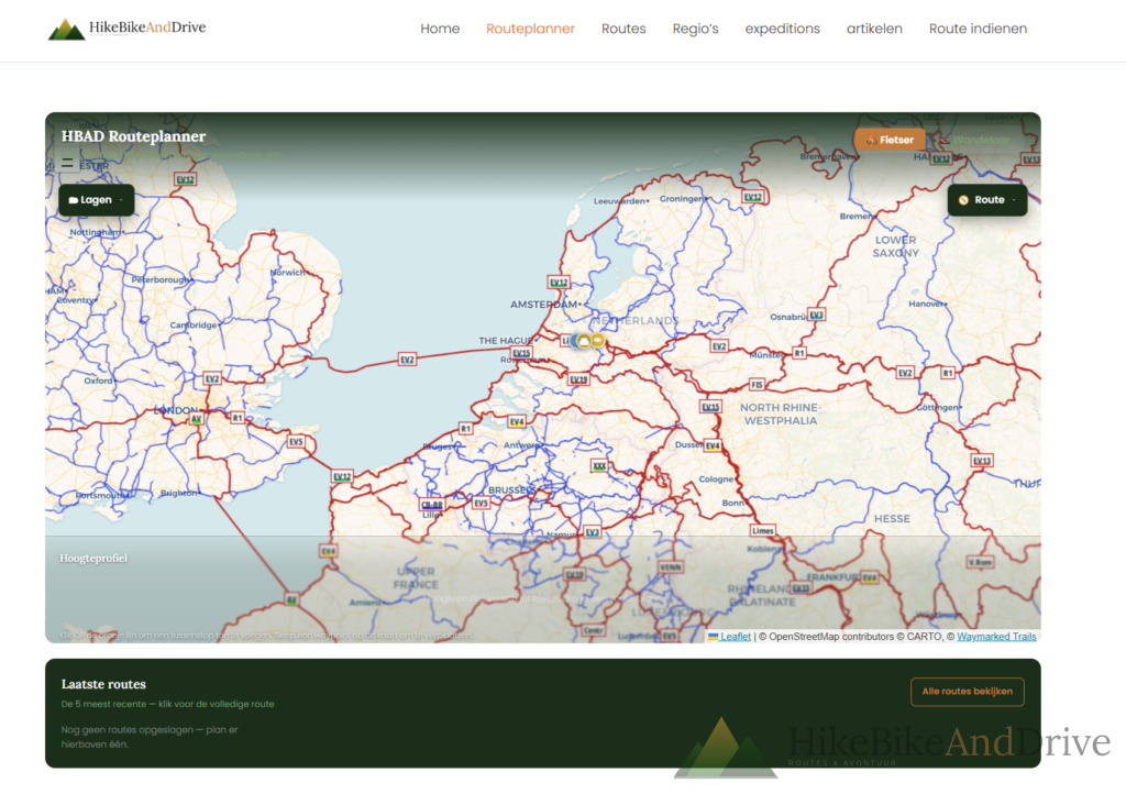
I Built My Own Route Planner Here’s What It Does
If you’ve tried planning a route on Komoot lately, you’ve probably noticed it. Pages that hang. Uploads that fail halfway. A GPX that just won’t go through, no matter how many times you retry, nothing dramatic, but enough small friction that I started wondering Whether a simpler tool built specifically for the kind of routes I plan might just work better for me.
So I built my own.
Click. Click. Click. Route.
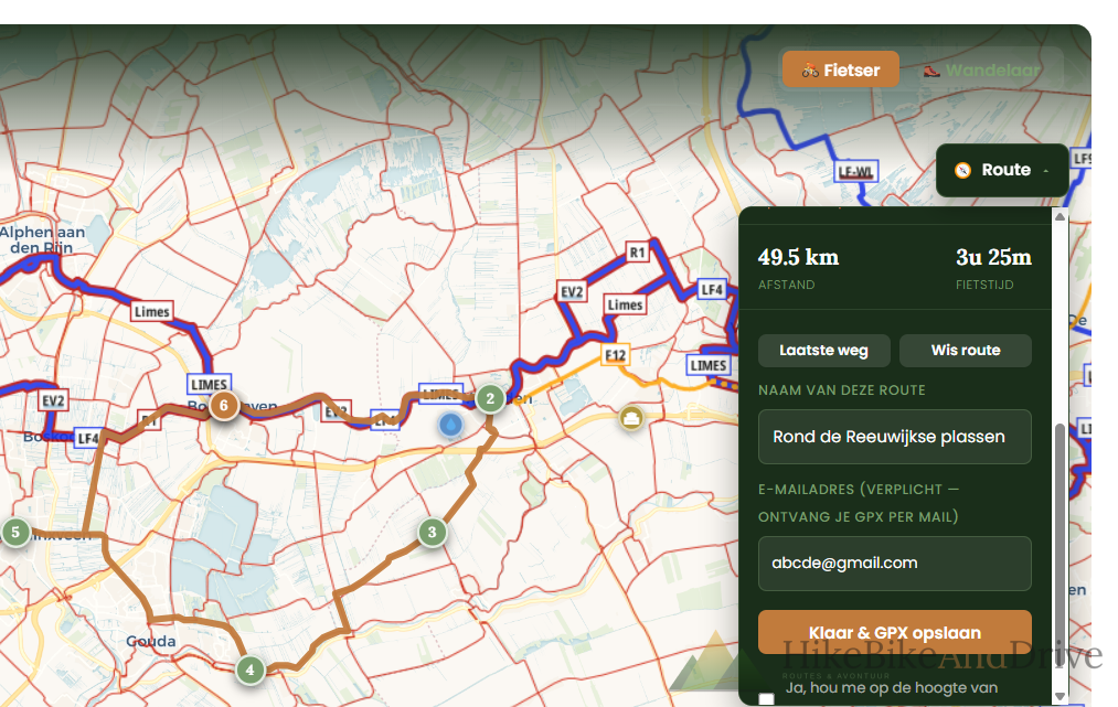
The idea is simple: you click a start point on the map your front door, a train station, wherever and then click your next point, and the next. Every time you add a point, the planner draws the actual route between them, following real cycling or walking paths, not a straight line through someone’s back garden.
Change your mind about a point? Drag it to a new spot, or delete it. Want a stop between two points you’ve already placed? Click directly on the route line and a new waypoint drops in exactly there.
Coming back to where you started to make a loop? One click adds it.
It knows the difference between a bike and your feet
Switch between cyclist and hiker mode with one tap, and the whole route recalculates different paths, different pace, different estimated time.
A real elevation profile, while you’re still planning
As you build the route, a live elevation chart fills in underneath the map not after you’re done, but while you’re clicking points. You’ll see the hill coming before you’ve even finished the route, which has already saved me from a couple of unpleasant surprises.
Multi-day trips, properly
This is the part I use most myself. If you’re planning something over several days say, a long weekend from Bodegraven toward the Achterhoek you can mark any point as “end of day.” The planner then treats each day as its own leg: its own distance, its own time, its own slice of the elevation chart, and its own separate GPX file if you want to load just one day onto your device at a time.
Save it, email it, ride it
Once you’re happy, give the route a name and hit save. You’ll get:
A GPX file, ready to download
The same file sent straight to your inbox open it directly from your phone into Wahoo, Komoot, or whatever you navigate with
A permanent page for that route on the site, so you can find it again later
A simple toggle to mark a route as planned or ridden, once you’ve actually done it
Fietsknooppunten, live on the map
If you’re routing through the Netherlands, you can switch on the live cycling node layer and see the actual numbered junction signs appear on the map as you pan and zoom the same system as the physical signposts.
Try it
It’s new, it’s free, and it’s still evolving if something breaks or feels clunky, that’s useful to know.